See the whole site. Know what’s moving.
Georeferenced drone site maps delivered on a recurring schedule — so your team, your owners, and your stakeholders always have a current view of the full project footprint.
RTK GPS · GeoTIFF & JPG Export · Central Iowa · FAA Part 107 Licensed
One map.
Every inch
of your site.
with RTK GPS
flight to delivery
every visit
An orthomosaic map is a high-resolution aerial image of your entire construction site — assembled from dozens of overlapping drone frames and corrected for camera angle and terrain distortion so every pixel is geometrically accurate and to scale.
The result is a georeferenced overhead map you can measure, compare, and share — not just a pretty picture. With RTK GPS enabled capture, positioning is RTK-corrected throughout, making these maps useful for grading verification, earthwork tracking, and site-wide progress documentation that holds up to scrutiny.
Drone capture across the full site
We fly a programmed grid pattern at consistent altitude, capturing overlapping high-resolution frames across the complete project footprint.
Photogrammetry processing
Software stitches the frames using structure-from-motion algorithms, aligning each image and correcting for distortion to produce a single seamless map.
Delivered, labeled, and ready to use
You receive a dated JPG for reports and sharing, plus an optional GeoTIFF for GIS or BIM environments — organized, named, and in your cloud folder within 24 hours.
Explore a real
site map.
Pan, zoom, and inspect every corner of an active project site — the same viewer your team would get. The map below is a real deliverable, not a demo: the runway reconstruction at Ankeny Regional Airport, captured 7/27/2026 with RTK GPS positioning.
↑ Use scroll or pinch to zoom. Click and drag to pan. Every capture session from this project is published on our Ankeny Regional Airport progress log. Contact us to see a sample for your site type.
Your site
in three
dimensions.
The same drone flight that produces your orthomosaic also generates a full 3D mesh of your site — giving your team a spatially accurate model to navigate, review, and share.
- Visualize grading progress, cut/fill areas, and earthwork elevation changes over time
- Communicate site conditions to remote owners, stakeholders, or lenders who can’t walk the site
- Support VDC and BIM teams with as-built visual reference at key milestones
- Document stockpile locations and approximate volumes for resource planning
- Generate a record of site conditions before, during, and after significant earthwork activity
See what changes
between visits.
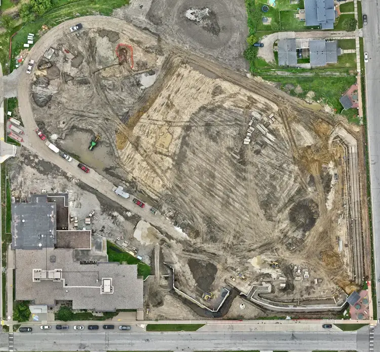
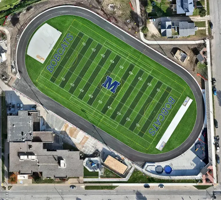
Drag the handle left or right to compare two orthomosaic captures from the same site, weeks apart.
Documentation that
works as hard as you do.
Orthomosaic mapping isn’t just a picture from the air. When deployed consistently across a project timeline, it becomes one of the most useful tools in your documentation stack.
Repeatable Sitewide Documentation
Every flight follows the same programmed plan at the same altitude — producing maps that are directly comparable week over week, month over month, throughout the project life.
Progress Verification
Provide owners and stakeholders with dated, georeferenced documentation of advancement across the site — reducing ambiguity about what’s been completed and when.
Grading & Earthwork Visibility
Track cut and fill progress, monitor grading activity, and create a visual record of earthwork milestones that supports your superintendent’s and engineer’s reporting.
Owner & Stakeholder Reporting
Deliver polished, professional site updates to project owners, investors, or board-level stakeholders who need visibility without being on site every week.
VDC & BIM Reference
GeoTIFF-format orthomosaics can be imported into GIS platforms and used alongside BIM models as a current as-built visual reference for your VDC team.
Historical Record & Dispute Protection
A dated, georeferenced archive of your full project timeline is one of the most defensible records you can maintain — should scope, schedule, or condition disputes arise later.
Put your site on
a mapping program.
Orthomosaic mapping delivers the most value when it’s recurring — the same site, the same flight plan, documented consistently from groundbreak to closeout. Tell us about your project and we’ll build a program around it.
Service area
Orthomosaic mapping across the Des Moines metro
Recurring drone documentation programs for commercial construction throughout Central Iowa: