Built for the sites
that matter most.
Recurring aerial documentation programs built for complex construction environments. Consistent deliverables, standardized cadence, and organized reporting — from first earthwork to final closeout.
Featured project · Public project, no NDA
Ankeny Regional Airport — Runway Construction
A live documentation program for the City of Ankeny, running the same recurring cadence we use on private commercial sites. Every capture session is published as the work advances — the clearest picture of what an ongoing program actually looks like.
Project Highlights
Repeatable programs.
Real results.
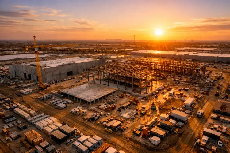
Data Center Construction
Central Iowa
Long-term recurring documentation programs supporting hyperscaler construction across Central Iowa — large-footprint, multi-phase campus builds requiring consistent aerial visibility from initial earthwork through final commissioning. Client identities are confidential.
SE Polk Middle School
Altoona, IA
Long-term aerial documentation of the Southeast Polk Middle School build in Altoona — full build cycle captured across 2023–2024, from initial earthwork through opening. Consistent progress photography and milestone video supporting district reporting and community updates.
City of Urbandale
141 Flyover & 100th Street Bridge
Public infrastructure documentation for two City of Urbandale projects — the 141 Flyover interchange and the 100th Street Bridge. Consistent aerial photography and milestone video throughout construction, providing a reliable visual record for city reporting and public communications.
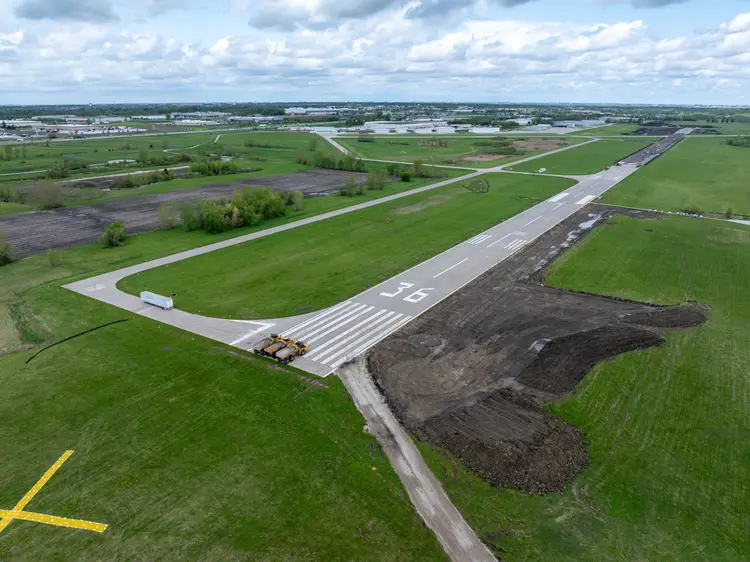
Ankeny Regional Airport
IKV · Ankeny, IA
Aerial documentation of Ankeny Regional Airport (IKV) — runway, taxiway, and facility imagery captured under FAA Part 107 with airport coordination. Useful for facility planning, public communications, and recurring asset documentation.
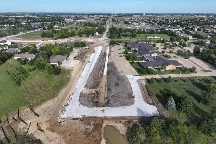
University Avenue Extension
Waukee, IA
The last 0.7-mile gap in University Avenue across the metro, between S Warrior Lane and 6th Street — captured under the full program standard as a self-funded demonstration. No client on this one: it exists so you can see exactly what one visit produces on a live heavy-civil site.
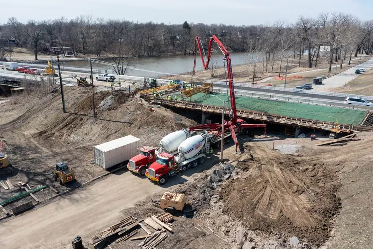
Manatt’s
Bridge Deck & Paving
Event coverage for a statewide concrete and paving contractor — a bridge deck pour captured during placement, plus three further Iowa projects across 2023. Work that exists for one day and is then buried under the finished structure.
Paws & Pints
Des Moines, IA
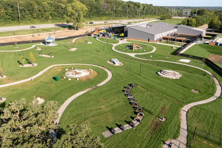
Three years with the owners — due-diligence filming from 2019, before there was even a site, then nine flights from bare grass to opening day at a seven-acre canine retreat. Progress documentation that doubled as the launch material.
Kettlestone Social
Waukee, IA
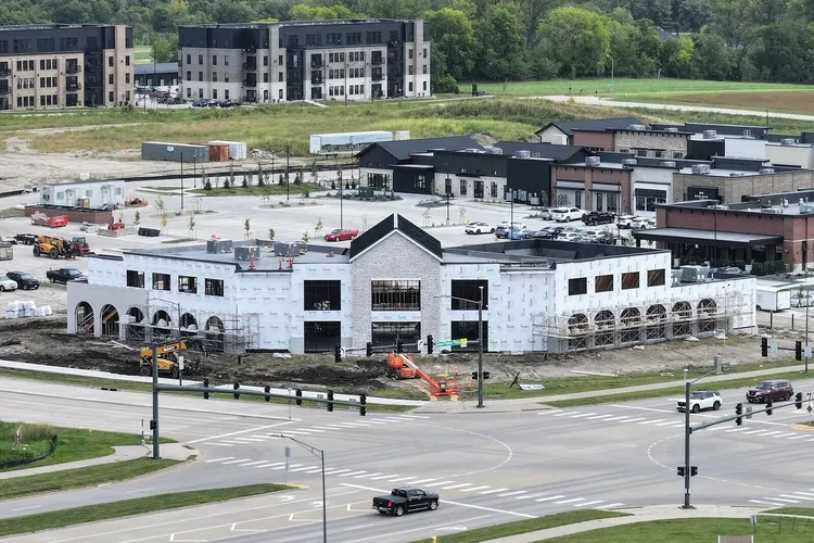
Waukee’s food hall and rooftop bar going up at Grand Prairie Parkway and SE Westown — a self-funded demonstration flown to the same standard as any client program. No contract with the owner or contractor; a recent, local, publicly shareable example of a single capture session.
Hawkeye Truck Equipment
Central Iowa
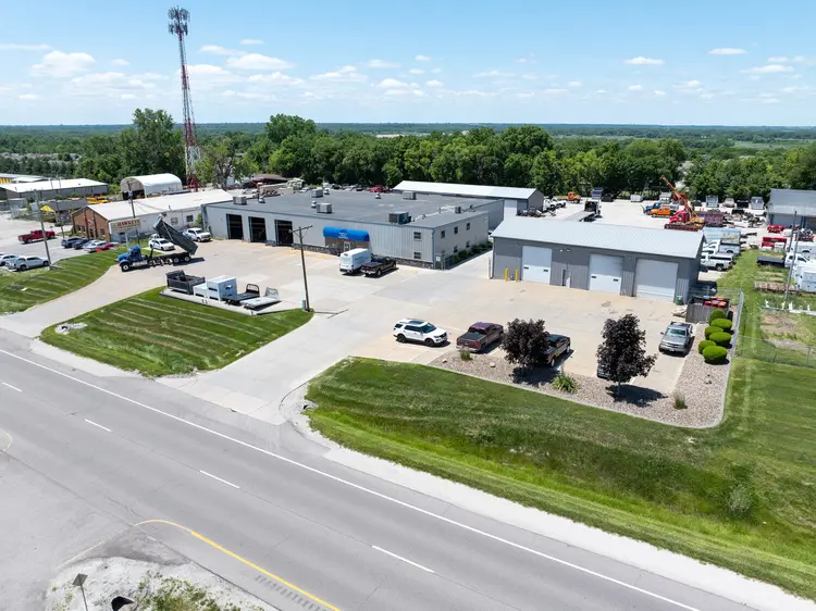
Facility and finished-unit photography for a local truck upfitter — the shop, the yard and the inventory in a single frame, plus completed units before delivery. Three visits across twenty-one months, framed to match.
Marshalltown School Updates
Franklin Field
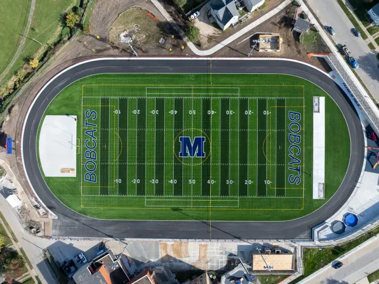
Aerial documentation supporting school facility updates and athletic field improvements in Marshalltown. Orthomosaic baselines established at project start for consistent comparison across phases, with structured progress photography delivered throughout the build.
Every engagement follows the same structure — organized files, consistent framing, and a clear capture summary after each visit. Additional hyperscale, healthcare, and corporate construction projects under NDA — reference list available on request.
What You Receive
Consistent deliverables,
every visit.
Every program produces the same organized, labeled, shareable outputs — visit after visit, so your data is always comparable.
RTK georeferenced overhead maps. GeoTIFF export, consistent georeferencing, comparable week over week.
Same angles, same altitudes, every visit. High-res JPGs organized by date and zone for instant comparison.
Milestone flyovers edited for owner updates, lender draws, and executive review. Branded edits available.
Interactive shareable panoramas for remote stakeholder access. Full perimeter coverage at milestone points.
Ready to put your site
on a documentation program?
Tell us about your project and we'll follow up within one business day with a quote and available schedule.
Featured case study · NDA-protected
Iowa Hyperscale Data Center — 18-month documentation program
72+ weekly flights, RTK orthomosaics for the VDC team, phase-milestone 360° captures, and procurement-ready credentials delivered into Procore + DroneDeploy + Bluebeam.